Book Tickets Online
About
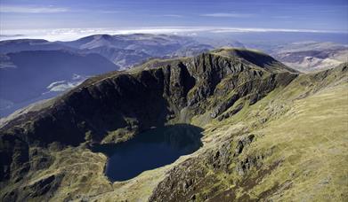
Cadair Idris, which means 'Chair of Idris' from the giant warrior poet of Welsh legend, is a spectacular mountain reserve in Southern Snowdonia of over 450 hectares of breathtaking landscape, rugged summits, glacial lakes and a mossy wooded gorge.
The distinctive shape of the mountain's peaks can be seen for miles around, from the coastlines at Tywyn and Barmouth and high over the market town of Dolgellau. The summit of Penygadair is a sharp contrast to the gentler hills below - when the clouds lift from the peak, that is!
There are three recommended routes to conquer Cader Idris. It’s not an easy walk by any means, whichever route you take. They are all designated ‘hard/strenuous’ routes, and you should allow between five to six hours to get there and back. You’ll need to take plenty of food and drink as there isn’t a café (or toilet) on the summit.
All routes include steep and often slippery sections, with loose stone and shale surfaces. There are gates and stiles on all routes, take care on the wet and boggy areas. Wear good walking shoes, take suitable clothing with you and carry water and food with you.
Even in summer the temperature at the top can be several degrees lower than in the car park. Low cloud often covers the summit, so it can be damp as well as cold. You can find advice relating to mountain safety on the Snowdonia National Park website advice before heading out on the mountain.
Cader Idris is a very popular day out for school parties, sponsored walks, or group challenges, especially as it is one of the Welsh Three Peaks.
LLANFINHANGELL Y PENNANT PATH (10 miles, 16 kilometres).
This is the easiest of three paths to the summit but also the longest. The walk takes approximately seven hours to the summit and back.The route starts from the valley of Llanfihangel-y-pennant. Free parking by the church.
Grid Reference: SH 672 089
Ascent - 2844 ft (867 m)
MINFFORDD PATH (6 miles, 10 kilometres).
The Minffordd Path is one of three paths to the summit and is the hardest route. The walk starts from the Visitor Centre and takes approximately three hours to the summit and there is a shelter at the top of Cadair Idris for use during inclement weather.
THE PONY PATH (Ascent - 2,384ft (727m), 6 miles, 10 kilometres).
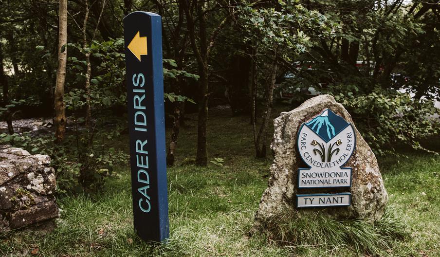
This Pony Path starts from Ty Nant and is the main footpath up Cader Idris from the Dolgellau side of the mountain. It is a reasonably safe route, which also offers the most rewarding views.
You can find advice relating to mountain safety on the Snowdonia National Park website advice before heading out on the mountain.
Book Tickets
Facilities
Accessibility
- Disabled toilets
Catering
- On-site light refreshments
Parking
- Parking with charge
Property Facilities
- Public toilets
Target Markets
- Accepts groups
- Coach parties accepted
Map & Directions
Road Directions
Public Transport:
Bus services 30,32,34 [Dolgellau-Tywyn-Machynlleth] run on the A487, stopping at the junction with the B4405 close to the entrance of the car park. The T2 Trawscymru service stops at Minfordd and Dolgellau
The nearest main line railway stations are Machynlleth, Tywyn and Barmouth.
www.Traveline.Cymru is a useful journey planner for public transport in the region.
By Car: Cadair Idris Visitor Centre Car park is signposted off the A487. The Minffordd path to the summit of Cadair Idris also starts from this location.
Accessible by Public Transport: Tywyn station is 10 miles away.


 to add an item to your Itinerary basket.


