To provide you with the best experience, cookies are used on this site.  Learn more

Allow cookies
Abbey Cwm Hir

Book Tickets Online

About

Glyndwr's Way is an 135 mile (217 Km) long National Trail through that takes you to some of the finest landscape features in Mid Wales including the tranquil Radnorshire Hills, the shores of the Clywedog Reservoir near Llanidloes and heather clad Pumlumon, which is the highest peak in the Cambrian Mountains.

There are spectacular views over Cadair Idris, Lake Vyrnwy, the Cambrian Mountains and Y Golfa. The route reaches its highest point at Foel Fadian (1530ft/510m) from which on a clear day views stretch out to Machynlleth in the heart of the UNESCO Dyfi Bioshere and the Cardigan Bay Coast.

This Trail takes you through a real farming landscape. One of the major attractions of the Trail is the joy of walking through a working land, there is nothing artificial about this landscape.To walk the entire trail usually takes around 9 days to complete however you can enjoy Glyndwr's Way as a series of day walks. Approximately 60% of Glyndwr's Way is available for cyclists & horse riders

Anyone who is reasonably fit can walk the Glyndwr's Way, although it is very hilly, often dropping into valleys and ascending hills several times in a day. You should be aware that it crosses country that is sometimes rough and remote. The ability to navigate by compass will be very welcome if it is misty.

The Trail starts at the Town Clock in Knighton on the Welsh / English border and ends at the Montgomery canal in Welshpool. This is the way most people walk it. The Offa's Dyke Path National Trail connects Welshpool and Knighton and offers a circular option for those wishing to complete the Trail as a continuous walk.

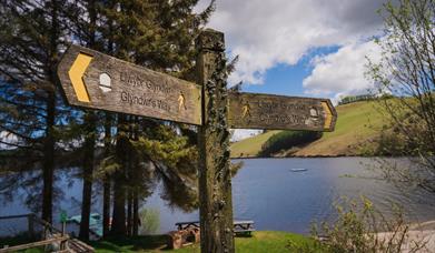
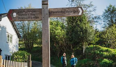
As a National Trail, the Glyndwr's Way is well signed throughout its length. You will see a distinctive acorn symbol on stiles, gates and signposts. This is the symbol used by all the English and Welsh National Trails. In addition you will see a dragon, which is the logo for the Glyndwr's Way.

Symbols on the Trail or on connecting paths, indicate whether the route can be used by vehicles, horse riders, cyclists or walkers.

Book Tickets

Facilities

Routes

  • Countryside
  • Length of route (miles) - 135 mile (217 Km)
  • Long Distance Path

Target Markets

  • Dark Skies / Stargazing

Map & Directions

Road Directions

132 mile National Trail starting at Knighton

The nearest railway station is Knighton, which is 0 miles away.

Glyndwr's Way National Trail

Type:Walking Route

Trail Start - Knighton, Powys, LD7 1EN

Add Glyndwr's Way National Trail to your Itinerary

Close window

Call direct on:

Tel01597 827562

Related

Knighton,PowysGlyndwr's Way | Knighton - Llanidloes, KnightonThe 135 m/217km National Trail is a long distance walk which can be enjoyed as a continuous journey, typically taking around nine days, or over a series of weekend or day trips.

Glyndwr's Way, Llyn ClywedogGlyndwr's Way | Llanidloes - Machynlleth, LlanidloesA 132 mile National Trail set in the heart of Mid Wales breathtaking countryside, dedicated to the 15th century Welsh warrior Prince Owain Glyndwr

Glyndwr's Way | Pererindod MelangellGlyndwr's Way | Machynlleth - Llanwddyn, MachynllethA 132 mile National Trail set in the heart of Mid Wales breathtaking countryside, dedicated to the 15th Century Welsh Prince Owain Glyndwr

Dyfnant / lake Vyrnwy ForestGlyndwr's Way | Llanwddyn - Welshpool, WelshpoolA 132 mile National Trail set in the heart of Mid Wales breathtaking countryside, dedicated to the 15th Century Welsh Prince Owain Glyndwr

What's Nearby

  1. The Offa's Dyke Centre is positioned at about the halfway point of the Offa's Dyke Path…

    0.04 miles away
  2. The Spaceguard Centre is a working observatory, and the main source of information
    about…

    1.36 miles away
  3. Friends of St Michael's raise funds for the ancient church on the Welsh border near…

    4.91 miles away
  4. Explore the fascinating world of the Victorian Judges, their servants and felonious…

    5.32 miles away
  1. Just outside the historic town of Presteigne, Nash Wood lies half in Wales and half in…

    5.89 miles away
  2. Located near Presteigne on the Welsh border, The Rodd is a must-visit attraction for art…

    6.51 miles away
  3. A low-lying reserve with Knobley brook running through the wet grassland. Butterflies…

    6.92 miles away
  4. Hergest Croft Gardens near Kington on Wales / Hereford border has been created over 130…

    9.78 miles away
  5. Warren Wood has been popular with tourists for over 200 years because of the waterfall…

    9.93 miles away
  6. Warren Wood has been popular with tourists for over 200 years because of the waterfall…

    9.93 miles away
  7. The Pales is the oldest Quaker Meeting House in continuous use in Wales. Set in the…

    10.29 miles away
  8. Ceri Forest is a coniferous forest which sits astride the Kerry Ridgeway in the uplands…

    12.14 miles away
  9. The vineyard was planted in 2010 and covering six acres of farmland, the vineyard resides…

    13.14 miles away
  10. From the top of Roundton Hill it's easy to see why an Iron Age hillfort was once sited…

    13.79 miles away
  11. Cmw Weeg is a magical place with 3 acres of landscaped gardens surrounding a medieval…

    14.34 miles away
  12. The Old Bell, a 16th century inn, has been converted into a local history museum by…

    15.43 miles away
Previous Next

Don't Miss

Don't Miss

Don't Miss

Don't Miss

Don't Miss