Book Tickets Online
About
Mid Wales Rail Trails | Points of interest on the train journey departing Barmouth station to Porthmadog (Left or Right refers to when facing direction of travel.)
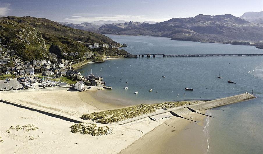
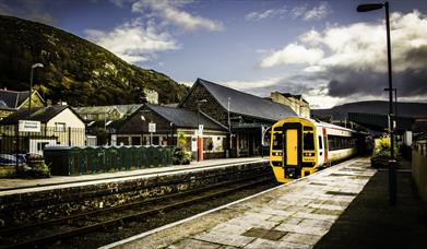
Depart Barmouth. When the line to Ruabon was still open, apart for some peak holiday through trains, most services on that line originated or terminated at Barmouth. Some trains from Pwllheli/Porthmadog and from Machynlleth also started or finished their journeys here. The former goods yard was on the right and is now occupied by a Co-operative supermarket; there was a siding that served the gas works. On the left were more sidings, a turntable and Barmouth North signal box. The line now runs in between the A496 road to Harlech and the sea.
Llanaber. R - the station platform is reached by a steep path from the road just...Read More
About
Mid Wales Rail Trails | Points of interest on the train journey departing Barmouth station to Porthmadog (Left or Right refers to when facing direction of travel.)
Depart Barmouth. When the line to Ruabon was still open, apart for some peak holiday through trains, most services on that line originated or terminated at Barmouth. Some trains from Pwllheli/Porthmadog and from Machynlleth also started or finished their journeys here. The former goods yard was on the right and is now occupied by a Co-operative supermarket; there was a siding that served the gas works. On the left were more sidings, a turntable and Barmouth North signal box. The line now runs in between the A496 road to Harlech and the sea.
Llanaber. R - the station platform is reached by a steep path from the road just below the village and the church and immediately above a rocky beach; the 2014 storm damage north of Barmouth that we referred to before occurred just on the Harlech side of the this location - 800 tonnes of debris were deposited on the line. Until the late 60s, Llanaber, together with a number of other small stations on the line, was referred to as a ‘Halt’ in timetables and on station name boards.
Talybont. R - Station on either of a bridge under a small road leading to the sea. The village is also to the right; mostly caravan and holiday home parks to the left. We then cross the Ysgethin River and move a little further inland.
Dyffryn Ardudwy. L - Station by a level crossing - the road from the village (right) leads to a caravan park. R - The former station building (now a private residence) and the ‘orphaned’ up platform from the days when there was a passing loop, signal box and a small goods yard here. We continue to travel a little further inland but still with the A496 road on our right. Llanbedr Airport will be on our left; opened during WWII as a base for the RAF’s Fighter Command and subsequently used for Target Drone services to the UK Armed Forces, it reopened in 2014 catering for the needs of general aviation activities in the area. It was on the UK Government’s short list of six airports being considered for the site of the UK spaceport!
Llanbedr. L - The station is beside a level crossing on the road from the village (right) to Shell Island, a popular tourist destination. It was called Talwrn Bach until 1978 when the name was changed together with that of the next station. We cross the Afon Artro by a timber bridge just prior to Pensarn.
Pensarn. R - This station was called Llanbedr and Pensarn until 1978. It is almost alongside the A496 road with the small village off to the right. Former small goods yard, signal box and passing loop but the station only ever had the one platform.
Llandanwg. L - One of the stations previously called a ‘Halt’, it is a very short platform. The village is on both sides of the line and the bridge over the railway carries the road through the village off the A496 and to the beach. We briefly return to running alongside the coast.
Harlech. The station is just after a level crossing over the A496. To our right, Harlech Castle towers over the station; the main part of the town is at the top of this hill. Station buildings on left, passing loop, two platforms and a footbridge. The waiting shelters are because of the high numbers of children that travel by train to and from schools here - in fact this school traffic drives the timetable. A signal box (which was in use until radio signalling was introduced in 1988) was on the left (just before another level crossing) and a goods yard on right. Passenger journeys recorded here (prior to the line closing in 2014) were around 125,000 a year.
Depart Harlech; the line now heads north-east to negotiate the Dwyryd estuary.
Tygwyn. L - Located just before another level crossing with the A496, the little station survived British Rail’s closure application in the mid-1990s. Passengers only average five or six a day.
Talsarnau. R - The station building is now a private house; a signal box adjoined which controlled two goods sidings and a level crossing over a farm track. A lane leads from the station to the village which is alongside the A496. The station building is now a private house.
Llandecwyn. R - The small station, just big enough to accommodate the two carriage trains, was completely reconstructed during the summer of 2014 as part of the £20 million scheme to replace the nearby Pont Briwet. This Grade II listed timber bridge, built in the 1860s, carried the railway over the Dwyryd to Penrhyndeudraeth and a single lane, privately owned toll road which connected the A496 Harlech to Blaenau Ffestiniog road with the A487 from Porthmadog; both were in a very poor state of repair. The project included a bridge for the railway, a two-lane road and a cycle/footpath. The bridge opened to rail traffic on 1 September 2014 with services between Harlech and Pwllheli recommencing after a gap for 9 months and work on the parallel roadway was fully completed in 2015. After the bridge, we turn west for the final few miles of our journey today.
Penrhyndeudraeth. R - The road opposite the station leads to the centre of this large village which has a population of over 2,000. Just prior to the station is the site of a former explosives factory that at one time employed up to 600 people. Established in the 19th century to make gun cotton, a manufacturing plant was set up here to produce munitions for WWI and explosives for quarrying and mining; production of explosives continued until 1995. This factory provided freight for the railway with the explosives being carried in short wheel-based vans; this only ended in 1980 when freight on this line was discontinued due to problems with the Barmouth Bridge. Even then, the explosives still went by rail from nearby Blaenau Ffestiniog and Maentwrog Road.
The station building is now privately owned and close by was the signal box; as at Pensarn, although there was a passing loop here, the station only ever had the one platform. Penrhyndeudraeth had a comparatively large (for the line) goods yard and sidings. Current passenger usage for the station is 56,000 annually.
We now run south-west down to the Dwyryd estuary and then north to Minffordd.
Minffordd. We run under the main road to Porthmadog and the Ffestiniog railway which are adjacent to each other; the Ffestiniog also has a station here (the narrow gauge line pre-dates the Cambrian Coast line by some 36 years!) and our station (right) is reached by way of the Ffestiniog’s up platform. Minffordd had extensive exchange sidings between the standard gauge and narrow gauge railways taking slates out and bringing coal in. This continued until the Ffestiniog closed in 1946 but freight from here lasted until into the 70s.
Shortly after Minffordd on our right is the road-stone producing Garth Quarry; this once had its own siding to provide ballast for the railway. The new A487 Porthmadog bypass is on our right; we cross the Glaslyn and travel north of the town, over a level crossing with a road and then a level crossing with the Welsh Highland Railway.
We pass the Welsh Highland Heritage Railway on our right; this operates a mile long route from a station opposite the Cambrian Coast Line station - the new Welsh Highland Railway line now terminates at the Ffestiniog’s Porthmadog station. There is another level crossing (with the A4971 road) as we reach Porthmadog station; a signal box was next to the crossing on the left and this remained in use until1988.
Arrive Porthmadog and leave the train.
The station retains a passing loop and the station buildings are now ‘The Pub on the Platform’ - The Station Inn. Passenger journeys commencing and finishing here in recent years have been about 70-80,000 a year; the population of the town is around 4,200. In the days of steam, a water tower was behind the station with an engine shed just to the west (a sub-shed of Machynlleth - code 89C); locomotives and or crews changed here. The goods yard was behind the up platform.
Book Tickets
Map & Directions
Road Directions
Barmouth is located on the A493 coast road 10 miles from Dolgellau (A470/A487/A494).
Public Transport Directions
The railway station is located in the town centre by a level crossing just off the A496 and is also close to connecting public transport services and taxis. Car parking is located adjacent to the railway station.


 to add an item to your Itinerary basket.


