Book Tickets Online
About
This former limestone quarry is one of Wales' most outstanding botanical sites, famous for its exceptional variety of alpine plants and trees, some extremely rare.
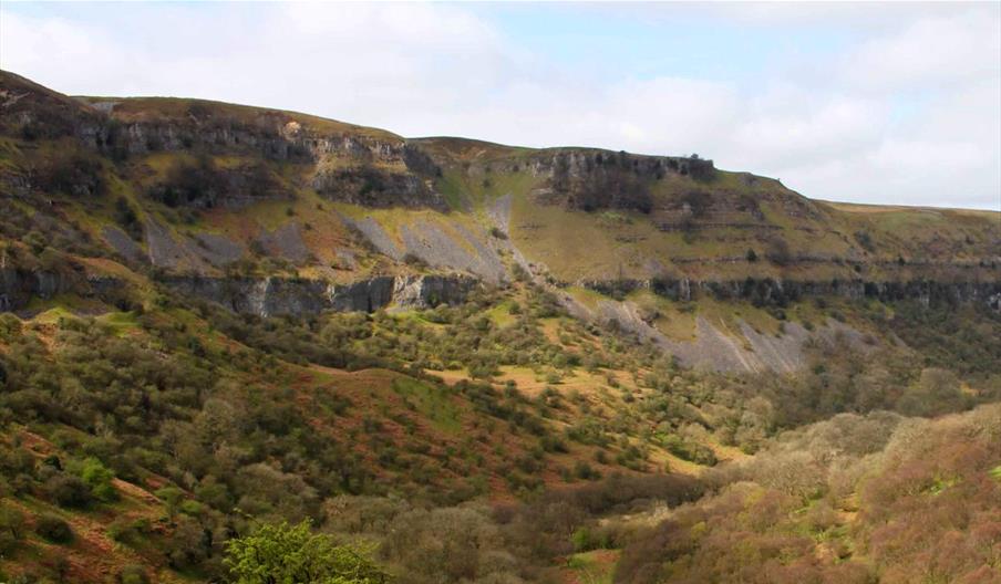
Craig-y-Cilau is no untouched wilderness. Take one look at its spectacular escarpment of limestone cliffs and its is strikingly obvious that large-scale quarrying once played a major role here. Sections of the cliff are scooped out while others remain in their natural state. It is this combination of natural and industrial history that gives the reserve its compelling character.
Perched high on the hillside above the Usk Valley, Craig-y-Cilau consists of a sweeping amphitheatre of cliffs and screes that curls around the edge of Mynydd Llangatwg. This craggy, 120m-high curtain is one of the largest limestone cliffs in South Wales. Together with its grassier, gentler lower reaches, it forms a reserve famous for its variety of plants.
In the 18th and 19th centuries, the cliffs were quarried for limestone, a key ingredient in the ironmaking process. The limestone was hauled by horse-drawn tramway – the route of which still exists – all the way to the ironworks at Brynmawr and by incline down to the Monmouthshire and Brecon Canal at Llangattock.
The reserve is open to the public. Access is free. Some areas are rough and slippery underfoot. The weather can change rapidly. Suitable clothing and footwear is essential. Rocks regularly fall off or over the cliffs; for your own safety keep away from the foot of cliffs. The reserve is grazed by ponies and sheep for most of the year. Please follow the Countryside Code and keep dogs under close control.
Book Tickets
Map & Directions
Road Directions
There are access points from the unmarked road out of Llangattock which joins the B4506 road between Llangynidr and Brynmawr. Alternatively, from Llangattock, follow Hillside Road for approximately 500m, then turn right onto another very narrow, winding and steep lane that will take you up to the top of the escarpment. Once up on the top look out for another very sharp right hand turn which leads to a track at the end of the road. OS grid reference SO186160.
Roadside parking, 200m from the reserve, and a car park, a mile from the reserve.


 to add an item to your Itinerary basket.


