Book Tickets Online
About
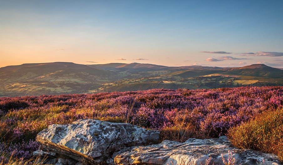
The Black Mountains are a group of hills spread across parts of Powys and Monmouthshire in southeast Wales, and extending across the national border into Herefordshire, England.
They are the easternmost of the four mountain ranges of hills that comprise the Brecon Beacons National Park, and are frequently confused with the westernmost, which is known as the Black Mountain. To confuse matters further, there is a peak in the Black Mountains called Black Mountain.
The Black Mountains may be roughly defined as those hills contained within a triangle defined by the towns of Abergavenny in the southeast, Hay-on-Wye in the north and the village of Llangors in the west. Another 'gateway' town to the Black Mountains is Talgarth
The highest mountain in the group is Waun Fach whose heavily eroded peat summit plateau attains a height of 811 metres (2,661 ft). Other significant summits towards the northern edge of the range include the 703 metres (2,306 ft) peak of Black Mountain with its northern outpost of Hay Bluff (Welsh: Penybegwn),[3] 677 metres (2,221 ft), Rhos Dirion, 713 metres (2,339 ft) and Lord Hereford's Knob or Twmpa, 690 metres (2,264 ft). Towards the south of the range are the more independent summits of Crug Mawr at 550 metres (1,804 ft), Pen Allt-mawr at 719 metres (2,359 ft) and the 701 metres (2,300 ft) peak of Pen Cerrig-calch which rises prominently above the Usk Valley.
Outlying summits, all of which are classed as Marilyns, include the Sugar Loaf, Mynydd Troed and Mynydd Llangorse. The lower and separate hills of Allt yr Esgair, Myarth, Bryn Arw and Ysgyryd Fawr (also known as 'The Skirrid', Skyrrid or 'Holy Mountain') are scattered along the southern fringe of the Black Mountains.
BRECON BEACONS DARK SKIES
Dominating the skyline above Crickhowell, the Sugar Loaf is one of the top ten places in the Brecons Beacons to stargaze. The mountain is tall enough to be above the cloud line giving access to clearer skies.Hay Bluff & Sugar Loaf Mountain are two of National Park's top ten sites for stargazing.
WALKING ROUTES & TRAILS
There are numerous walking routes in the Black Mountains including Sugar Loaf Trails near Crickhowell, Grwyne Fawr Reservoir Walk and many more.
Book Tickets
Facilities
Target Markets
- Dark Skies / Stargazing
Map & Directions
Road Directions
The Black Mountains lie within a triangle defined by the towns of Abergavenny in the southeast, Hay-on-Wye in the north and the village of Llangors in the west. Another 'gateway' town to the Black Mountains is Talgarth
The nearest railway station is Abergavenny, which is 0 miles away.


 to add an item to your Itinerary basket.


