Book Tickets Online
About
This walk starts in the small village of Cwrt. The Welsh ‘Cwrt’ is ‘court’ in English. Perhaps the village was the site of a Royal residence, however there is no evidence to prove this. The road between Pennal and Cwrt is called ‘wtra’r beddau’ or the lane of graves. Here a battle was fought between the soldiers of Thomas ap Nicholas (York) and Harri ap Gwilym (Lancaster) during the War of the Roses (1455-1485).
The former was victorious, but the road is said to be paved with the graves of lost soldiers. Look out for woodland birds as you walk up the road. You might see woodpecker, flycatcher, tree creeper and even redstart.
Eglwys Gwyddelod - This Bronze Age stone circle sits in a very dramatic setting on a rocky shelf, a point where several tracks converge. It is located for maximum impact from one direction - in this case, the south. The name Eglwys Gwyddelod ('Irishman's Church') is unusual; the Irish are usually credited with huts rather than churches in Welsh tradition.
Start: Village car park, Cwrt
Grid Reference: SH 688 000
Distance: 4.8 km – 3 miles (with extension 6.6 km - 4 miles)
Grade: Moderate (extension energetic)
Terrain: Tarmac road, firm tracks, fields and woodland
Maps: OS Explorer - OL 23
Refreshments: Riverside Hotel, Plas Talgarth Restaurant, village shop - Pennal
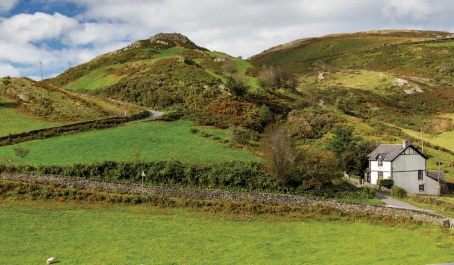
1. From the car park A cross the main road B to follow the minor road opposite signposted Cwm Maethlon/Happy Valley C for approximately 1.2 miles ignoring any turnings until you reach a white house on the R where the road swings L. For an optional extension to visit a stone circle continue steeply up the track immediately to the L of the white house for around 1 km through 2 Gs. The track eventually levels out and the circle D lies 150m beyond a third G on a rocky shelf above and to the R of the track. Return the same way.
2. Just before the white house at a FP sign on the L go through a G and follow the grassy track keeping the fence on your R. Go through a G, then immediately R through another to follow the L fence to another G. Through this with an old barn on your R. Walk across the field past a telegraph pole to go through a black G into the woodland. Keep fence on L, on along and down through a G. Walk down the field and where it opens out head diagonally L
and through a metal G into woodland. Cross the FB and through another black G to follow a wide grassy path through the conifer trees, keeping straight on at a fork until you reach a tarmac road. Turn L to the main road.
3. Turn R and carefully cross the main road to the entrance of Cefn Crib caravan park. Follow this tarmac track and where it bends R, take the first G on the L and follow the track to a junction then turn L. When the track bends L towards a G, keep on following the lower edge of the woodland through a kissing G. Follow the fence and bank on the L until you cross a FB and head up to the kissing G in the L corner of the field.
4. Turn L along the road back to the start
Book Tickets
Facilities
Parking
- EV Charging - 'Fast' electric vehicle (EV) charging - Maengwyn Street Car Park, Machynlleth, SY20 8DY
Routes
- Description of route - Moderate
- Length of route (miles) - 3 miles - 4 miles with extension
Map & Directions
Road Directions
The village of Cwrt is 4.6 miles form Machynlleth on the A489
Public Transport Directions
Nearest railway station is Machynlleth station which is 4.6 miles from Cwrt.


 to add an item to your Itinerary basket.


