Book Tickets Online
About
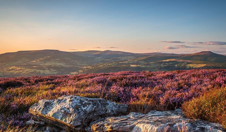
Pen Tir is one of the most westerly of the Black Mountains with beautiful views across high heather moorland west towards the Brecon Beacons and east towards the highest of the Black Mountains, Waun Fach at just over 810m.
There are many ways up and down the Sugar Loaf. This walk starts on the west of this striking and distinctly shaped hill in the small village of Llangenny, just to the east of the bridge over the Grwyne Fawr.
This walk is approx 4 miles long. It has some steep stretches and one steep descent. A compass is necessary especially if the weather is changeable. Allow 3 hours to complete the walk comfortably.
This walk starts at the Community Hall in Cwmdu to the west of Crickhowell. Take the A40 westwards out of Crickhowell. After approx 1.5 miles take the right turning onto the A479. Cwmdu is a small village approx 2.5 miles up the road. The Community Hall has a small car park on the right hand side of the road at Grid Ref: SO180240.
The car park is at the start of a small single track lane which runs parallel with the main road until it branches off up the Cwm Sorgwm. Start walking up the lane. It crosses the Rhiangoll stream. After a few hundred yards a path leaves the road steeply up to the left and turns back slightly on your previous direction, behind the land attached to the small cottage which fronts the lane on the left hand side. The path heads in a south westerly direction diagonally up the hill.
The path eventually forks. The lower fork goes off the the remains of the ancient hill fort (Coed y Gaer Grid Ref: SO176241). Take the upper fork which continues a little further up and goes round the end of the hill to the west.
The path you need next heads off to the right steeply up the shoulder of the hill in a northerly direction. It is not signed posted and the OS map suggests more than one path. Take the first clear path through the braken. It is a good idea to start taking compass bearings at this stage. Essentially you want to head almost due north. The views quickly open up and you are soon walking on the top. The summit of Pen Tir will stay on your right. The photo opposite is the view you will have looking east just after passing the highest point of Pen Tir.
You now need to head for the cairn at SO166262. It is a little tricky to spot as you approach from the south because it lies below the horizon and is therefore a little indistinct. You might want to take a compass bearing towards the grid reference point of the cairn. At the cairn take the path which leads off the hill to the east. Take a compass bearing on Grid Ref: SO170253.
The descent once you get to the lip of the hill is fairly steep, but the path is clear. The lane you join at the bottom is the same lane you started out on from the car park. Make sure you don't mistakenly cross the bottom of the valley to Blaenau draw but stay on the same side as Pen Tir.
Head along the lane towards Pencaeau Farm and beyond back to the start point.
Book Tickets
Facilities
Routes
- Accessibility of route - Grid Ref: SO180240
- Length of route (miles) - 4
- Typical duration of route - 3 Hours
Map & Directions
Road Directions
The Black Mountains lie within a triangle defined by the towns of Abergavenny in the southeast, Hay-on-Wye in the north and the village of Llangors in the west. Another 'gateway' town to the Black Mountains is Talgarth
The nearest railway station is Abergavenny, which is 0 miles away.


 to add an item to your Itinerary basket.


